Heavy rain and snow have sparked travel chaos as Storm Kathleen batters large parts of Scotland.
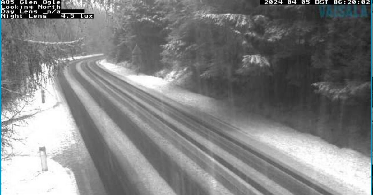
Motorists in the north of the country are being urged to drive carefully as gritters tackle affected routes on the A9, A85 and A889 on Friday morning.
Sharing snowy images on social media, BEAR NW Trunk roads wrote: “Snow affecting the A9 Slochd and Drumochter and the A85 Glen Ogle just now.
“We have gritters out treating routes and dealing with any snow but please drive safe and take care.” Heavy snowfall is also reportedly affecting parts of Tayside and Fife with flooding reported on the M90 motorway.
Meanwhile, a major train line has been closed due to flooding on the line with services delayed or cancelled. The route from Edinburgh to Glasgow via Shotts is currently out of action.
Join the Daily Record’s WhatsApp community here and get the latest news sent straight to your messages.
Network Rail Scotland engineers are currently on site assessing the situation and say they hope to rectify the issue “as quickly as possible” as early morning commuters have been advised of service changes.
According to ScotRail, Edinburgh to Glasgow Central services will terminate at Fauldhouse, Glasgow Central to Edinburgh trains will terminate at Carfin.
ScotRail has also requested buses to operate between Fauldhouse and Carfin. The UK is set to be battered by heavy rain and winds of up to 70mph during Storm Kathleen.
Wet and windy conditions were forecast to arrive on Friday, heading into Saturday, as the storm rolls in.
Travel disruption is possible as heavy downpours are expected across central Scotland, with a Met Office yellow weather warning for rain running from Friday between 2am and 9am.
The warning, covering the central, Tayside & Fife, south-west Scotland, Lothian Borders and Strathclyde areas, says there is likely to be “15-25mm of rain, much of this falling in around six hours with a few locations seeing up to 35mm overnight”.
Met Office meteorologist Greg Dewhurst said: “We have got heavy rain pushing north and east across the country through (Thursday night) and into (Friday) morning.”
However, he said that the rain will start to clear later on Friday morning. “So it will start to clear (Friday) morning but leaves a legacy of showers, and then perhaps some longer spells of rain as we go through the day across the north of the UK.”
A yellow warning for snow is in place on Friday from the early hours through to 9am covering central, Tayside & Fife, Grampian, Highlands & Eilean Siar and Strathclyde, with downfalls particularly expected over higher ground.
There could be snow accumulations of 10cm or more in places above 300 metres but “2-5 cm of snow is expected fairly widely above 250 metres, with a chance that a few places within the warning area at lower levels could see a few centimetres settle.”
Don’t miss the latest news from around Scotland and beyond – Sign up to our daily newsletter here.


