(Image credit: Chris Karagkelis)
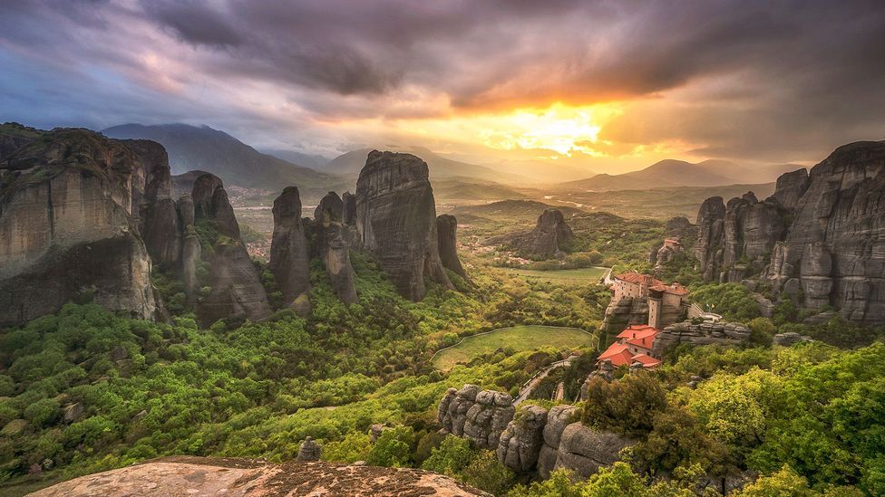
From dinosaur fossils in Brazil to the soaring monasteries of Meteora, these 18 new geological sites highlight a particular region’s natural, cultural and intangible heritage.
T
Travellers interested in deep dives into geology, culture and sustainability have several new destinations to place on their bucket lists. Unesco just announced the designation of 18 new Global Geoparks, bringing the total to 213 sites representing 48 countries around the world.
From crystal-clear karst lakes to an archipelago formed during the last ice age, these parks are more than just sites with unique geological features; they also serve to highlight a particular region’s natural, cultural and intangible heritage. “Unesco Global Geoparks represent landscapes where internationally significant geological heritage intertwines with human history and supports rich biodiversity,” explains António Abreu, director of the Division of Ecological and Earth Sciences at Unesco. “Each new geopark tells a unique story, using geology as its lens.”
Here are five of the newest geoparks on Unesco’s list:
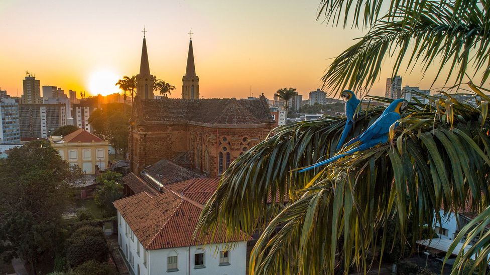
More than 10,000 fossils, and 38 hectares of preserved forest can be found in the newly created Uberaba geopark (Credit: Daniel Vitor Teodoro)
Known as the “Land of the Giants” because of the rich palaeontological heritage found here, this new geopark includes the south-east Brazilian city of Uberaba. It contains impressive geological formations, including the Serra da Galga and Serra Geral mountain ranges, which were formed by basalt flows and tell the story of ancient volcanic eruptions. There are also more than 10,000 fossils of dinosaurs and other prehistoric lifeforms here, and a 19th-Century farming tradition – using a unique cattle breed that produces lower CO2 emissions – contributes to the area’s ecological preservation.
Several themed “routes” or suggested itineraries allow visitors to experience the area’s unique geological and cultural features. A museums route directs visitors to sites such as Uberaba’s Paleontological Research Centre and Dinosaur Museum, and a “geosites” route highlights locations like the Vale Encantado (Enchanted Valley), a preserve which protects 38 hectares of forest, waterfalls and prehistoric rock formations. For more adventurous visitors, several hiking trails lead from outside the city directly through the Serra Geral National Park. Now part of the larger geopark, this mountainous region allows hikers to immerse themselves in the local ecosystem.
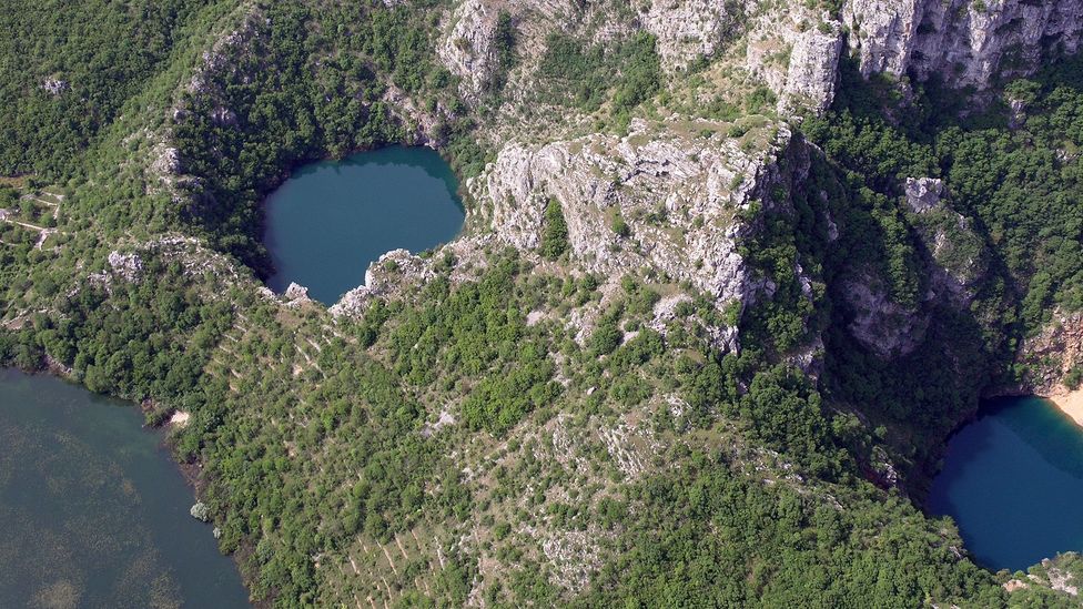
Imotski’s famous karst lakes were formed from a pre-historic cavern collapse (Credit: Biokovo Imotski Lakes Geopark)
Two distinct and unique geological formations make up the Biokovo-Imotski Lakes Geopark in southern Croatia. The first is Biokovo mountain range, accessible via the popular Biokovo Nature Park, which offers myriad outdoor attractions, including educational nature walks, mountain lookouts and even a botanical garden highlighting the flora found on these coastal mountain slopes. Here, the third-highest peak in the country, St George Peak, towers 1,762m above the sea.
The second formations can be found in the stunning blue waters of the nearby Red and Blue Lakes at Imotski, a small town in the region. Set at the bottom of Europe’s deepest karst lake crater, Red Lake is named for the reddish colour of the iron oxide-tinted cliffs that surround it, while Blue Lake is named for its incredibly blue waters, fed by snowmelt from the surrounding mountains. However, while Blue Lake is readily accessible to visitors interested in swimming and other aquatic activities, Red Lake is harder to reach due to its location at the bottom of a 500m-deep cavern.
There are also man-made sites to explore, including several medieval tombstones and the modern-day glass skywalk in Ravna Vlaška – an area of the park with vistas over nearby towns, mountains and the Adriatic Sea.
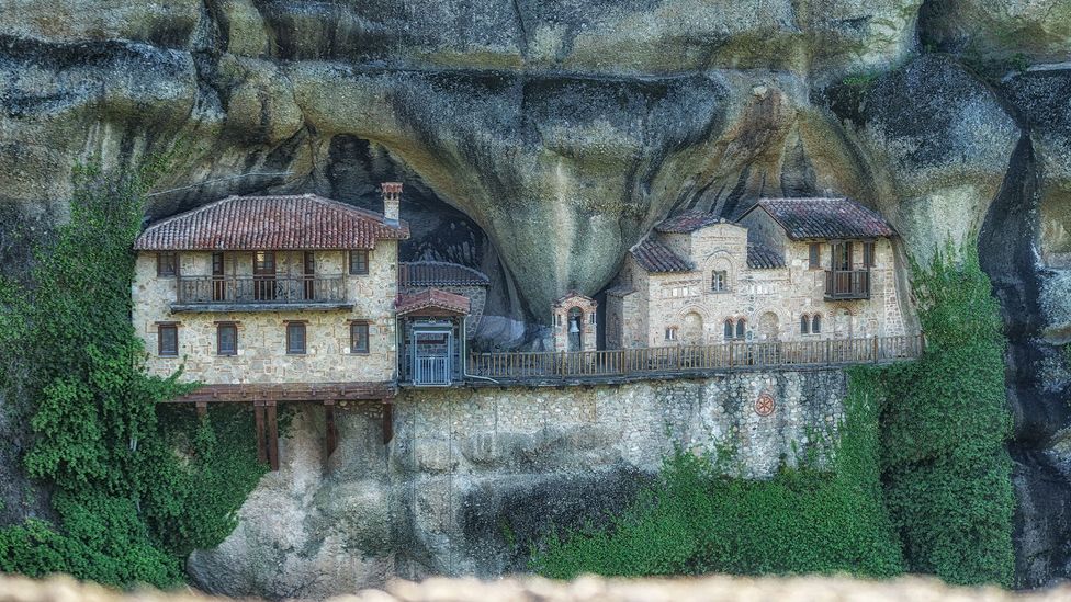
The monasteries at Meteora Pyli were already designated Unesco World Heritage sites. The new designation will preserve the surrounding landscape as well (Credit: Chris Karagkelis)
Meteora Pyli, located in Greece’s Thessaly region, bills itself as “a journey through space, time and geology”, and it’s no wonder, as many of its sites seem to seamlessly blend nature and culture. For example, the towering sandstone columns of Meteroa, some reaching as high as 300m, serve as perches for Byzantine-era monasteries built between 1200 and 1600 CE. Although this famed site had already received Unesco World Heritage status in 1988, the new geopark designation includes nearby geological wonders such as the Tafoni formations of Kalambaka, known for their honeycomb-like erosion patterns, and the varied biosphere of the Pindos Mountains, a favourite of hikers.
“The visitor can feel a unique experience in our region,” said Eleftherios Avramopoulos, Mayor of Meteora. “Especially due to the unique routes to the sacred rocks of Meteora and the villages hidden in the rich fauna of the Pindos Mountains.”
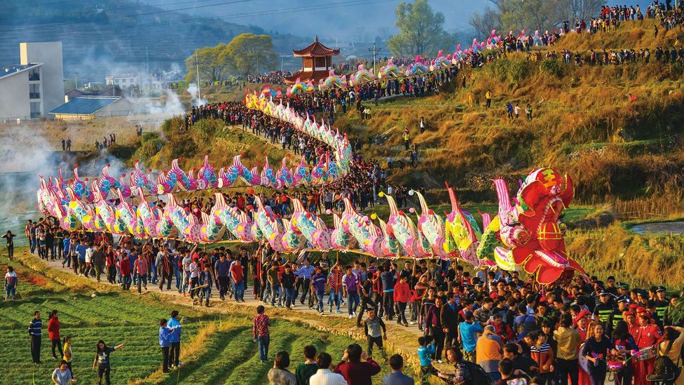
Longyan geopark helps preserve the living traditions of the Hakka culture as well as several endemic species (Credit: Longyan aUGGp)
Considered the centre of China’s Hakka culture, the city of Longyan in Fujian Province is known for its distinctive roundhouse-style buildings and compact cobblestone streets. The Hakka people who live in this area still hold onto unique traditions, such as the You Da Long festival, in which locals perform a dance in a large dragon formation, and Zou Gu Shi festival, a local carnival featuring woodblock printing and the wearing of traditional clothing. In addition to the cultural and architectural history, the geopark also extends to the natural forest which surrounds the city, the densest forest in western Fujian.
The new designation will help to protect the many endemic plant and animal species found here, including the Chinese yew tree and the South China tiger, all in the shadow of Meihuashan Mountain, known as the “Mother Mountain of the Fujian Province”.
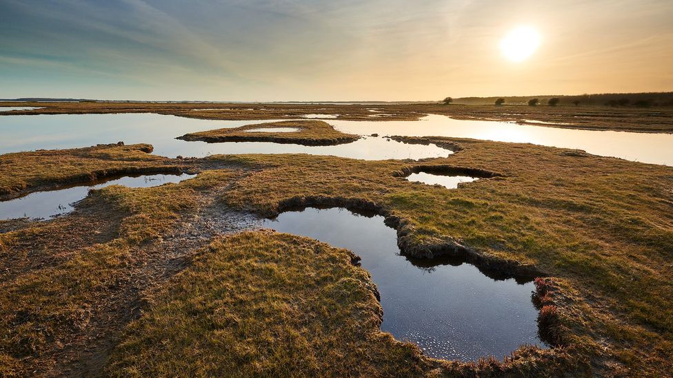
Visitors can explore the landscape of the South Fyn Archipelago by land or by sea (Credit: Mikkel Jezequel)
The South Fyn Archipelago is an example of what’s called a “drowned” ice age landscape, created by the dramatic rise in global water levels more than 10,000 years ago. Sometimes called “The Garden of Denmark” for its long history as an agricultural site, it encompasses around 55 islands and islets nestled in some of the best sailing waters in the world. Visitors can island hop across the archipelago by sailboat or go diving to experience the endangered marine ecosystem. On land there are plenty of opportunities for hiking, exploring and supporting the network of small local farms by sampling local produce.
“Unesco only designates geoparks to the list after very careful consideration and evaluation of all perspectives,” said Elsebeth Gerner Nielsen, chair of the Danish Unesco National Commission. “When the South Fyn Archipelago makes it through the eye of the needle, it means that the area can enlighten us about both the past and the future. It gives hope and is a fantastic example to follow.”
—
If you liked this story, sign up for The Essential List newsletter – a handpicked selection of features, videos and can’t-miss news delivered to your inbox every Friday.
Join more than three million BBC Travel fans by liking us on Facebook, or follow us on X and Instagram.
;


