
The Canary Islands‘ general directorate of emergencies has issued a pre-alert status for strong winds across all the islands. The warning is to be enforced from Wednesday, March 19 at 8am GMT (9am local time).
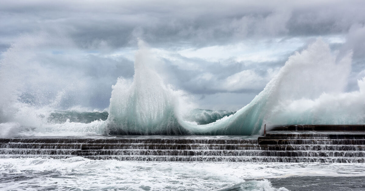
The warnings come as Storm Lawrench passes north of the archipelago, bringing with it powerful gusts of wind. As a result, the Government is urging residents to avoid unnecessary travel and to monitor traffic conditions if travelling by road to watch out for dangerous obstacles. Moderate westerly winds with locally strong gusts could reach up to 44 mph (70 kph) in the highlands, mountainous areas and mid-altitude regions of the eastern slopes of La Palma island, highlands and summits of El Hierro, the western half of La Gomera and the northern coastal areas of Tenerife.
Muncipalities including Adeje, Arona, Vilaflor, San Miguel de Abona, Granadilla, Arico and Fasnia are also expected to experience strong winds at alitutde.
As the day progresses, strong gusts will extend to other parts of the popular tourist archipelago, affecting the northwest and southeastern municipalities of Gran Canaria, as well as Lanzarote and Fuerteventura.
Citizens have also been advised to follow self-protection guidelines to minimise risks, to secure plant pots and other objects on balconies, terraces and rooftops that could be dislodged by the high winds. In the event of an emergency, residents and tourists should immediately call 112 and provide details of the incident so that appropriate emergency services can be dispatched.
The decision has been based on information provided by the Spanish State Meteorological Agency (AEMET) and other available sources, in accordance with the Canary Islands’ Specific Emergency Plan for Adverse Meteorological Phenomena (PEFMA) and the Special Civil Protection and Emergency Response Plan for Flood Risk in the Canary Islands.
Meanwhile, the coastal flooding alert that was in place as of 8pm local time on Tuesday, March 18, has been lifted by the General Directorate of Emergencies following an improvement in weather conditions. This means that the risk of coastal flooding caused by high waves reaching promenades, bathing areas and coastal roads during high tides is now over.
This new storm comes just a week after Storm Konrad battered the Atlantic archipelago, which forced AEMET to issue yellow weather warnings for heavy rain, predicting up to 15 litres per square metre in an hour and 40 litres over 12 hours across Malaga city, the Costa del Sol, Guadalhorce Valley, Axarquía, and Ronda on the mainland.
Tourists heading to Majorca in the Balearics are unlikely to escape the bout of poor weather, with a deluge of rain that could last into April.
Spain received as much rainfall in the first nine days of March as it typically does in the entire month.
We’ll be bringing you the very latest updates, pictures and video on this breaking news story.
For the latest news and breaking news visit:/news.
Stay up to date with all the big headlines, pictures, analysis, opinion and video on the stories that matter to you.
Follow our social media accounts here on facebook.com/DailyExpress and @daily_express