4 August 2025, 05:24

Picture:
Alamy, Met Office
Storm Floris is set to batter parts of the UK today, with ‘unseasonably strong’ winds of up to 90mph expected, the Met Office has warned.
The disruptive weather system, which arrives in the UK on Monday morning, brings strong winds and heavy rainfall across Scotland and the north of England.
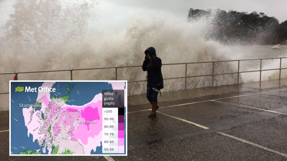
The strongest winds are most likely across Scotland during this afternoon and into the evening, with winds of up to 90mph affecting some exposed areas.
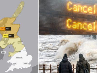
Weather warnings have been upgraded to amber for most of Scotland as Storm Floris bears down on the UK.
Read more: UK records fifth warmest July since records started, Met Office figures show
Read more: Storms and heavy rainfall driving up property insurance payouts – ABI
The warning lasts from 10am on Monday through to 10pm, with strong winds sweeping eastwards across the country.
It comes as Network Rail Scotland warned travellers to check before they travel, warning those who live near rail lines to “please secure any loose garden furniture, sheds and trampolines, to avoid tracks being blocked by debris’.
Train operator LNER has warned passengers to expect delays and cancellations in affected areas.
“We’re expecting heavy rain and high winds to result in disruption of services,” LNER said in a statement.
It comes as major disruption is expected, with the Met Office issuing similar advice for people to store or secure bins and outdoor items and check fences to ensure that they can withstand strong winds.
Dan Suri is a Met Office Chief Meteorologist. He said: “Much of Scotland is likely to see gusts of 50-70mph with more than 80mph on some exposed coasts, hills and bridges.
“Western coastal areas will see the highest gusts late morning, with the strongest winds transferring to northeastern Scotland by late afternoon.
“Across the wider Yellow warning area, many inland areas are likely to see gusts of 40-50mph, with 60mph likely at higher elevations and around some exposed coasts.”
There is also a yellow warning in place across areas of northern England and Northern Ireland from 6am on Monday through to midnight.
Many inland parts of the warning area will see westerly gusts of 40 to 50 mph and exposed coasts and high ground could see them reach 70 mph.
The Met Office has warned the strong wind could cause damage to buildings, and dangerous waves and beach material could be thrown onto sea fronts.
Heavy rain is also forecast, with transport disruption expected.
Road, rail, air and ferry services may be affected, with longer journey times and cancellations possible, the Met Office has warned
Met Office Chief Meteorologist Matthew Lehnert said: “Across the warning area, many inland areas are likely to see gusts of 40-50mph, with 60-70mph more likely at higher elevations and around exposed coasts in Scotland.
“There is a small chance that some locations here could even record gusts of 85mph.”
Storm Floris is the sixth named storm of the 2024/2025 Storm Naming season.
Storm Éowyn – which occurred in late January – was the last named storm to affect the UK.
Although named storms are more frequent in late autumn and winter, it is not uncommon for named storms to occur in summer.
RAC breakdown service’s Rod Dennis said: “This unseasonable bout of stormy weather will mean drivers in the north and west of the UK need to take extra care at the start of next week.
“It’s the height of the holiday season, so those towing trailers and caravans, as well as those with roof and tent boxes, must ensure their loads are properly secured.”
He advised motorists to slow down in poor weather, leave later if the conditions are too bad, and avoid exposed highland and coastal routes.

Picture:
LBC